Leica ULTRA Locator – Advanced
Leica ULTRA Locator – Advanced is backordered and will ship as soon as it is back in stock.
Couldn't load pickup availability
Hire
Hire
Many of our products are also available to hire.
Hiring comes with a number of benefits including:
- Easy access to the latest technology
- Reduced costs
- Short or long-term contracts
- Fast delivery and collection
Free UK Delivery *
Free UK Delivery *
We offer free delivery throughout the UK on all orders over £350.
Key information:
- We deliver to the UK Mainland only (i.e. England, Scotland & Wales).
- We will normally send your order to you the next working day for stock items.
- We dispatch orders Monday to Friday (excluding UK public holidays).
Price Match Promise
Price Match Promise
Our Price Match Promise is that, should you find any item cheaper elsewhere, we will aim to match or beat that price.
Finance Options Available
Finance Options Available
Subject to status, we are now able to offer Hire Purchase and Finance Lease on a whole range of equipment.
The complexity of underground utility networks are continually increasing.
So obtaining precise information on the location of buried utilities has never been more important. The protection of buried assets during excavation work demands accurate mapping and surveying of existing utilities.
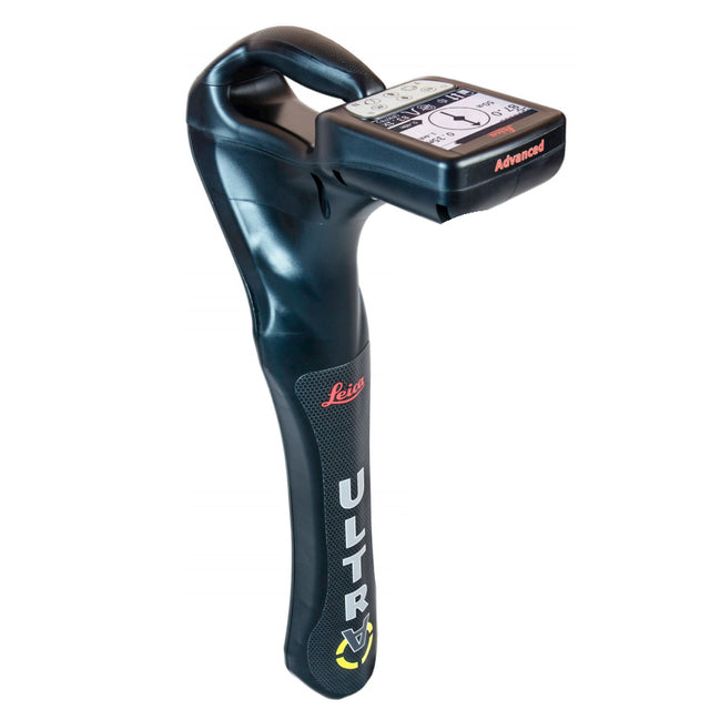
The Leica ULTRA provides our most advanced precision utility tracing system. Intelligent signal processing has been integrated with unique flexible operating modes, to help save you time and increased confidence in your results.
Selectable antenna and customised frequencies optimises your instrument for site specific applications, supported by our AIM system which monitors signal interference levels, recommending which mode to use for the best results.
- Ambient Interference Measurement (AIM) - When working in congested environments, external interferences can affect the effectiveness of utility tracing. To guard against interference, the Leica ULTRA incorporates advanced Ambient Interference Measurement (AIM), which analyses the surrounding area for noise and recommends the best frequencies for accurate utility tracing.
- Offset Measuring - There will always be an occasion when the utility runs close too, or underneath an obstruction. With Offset Measuring, the Leica ULTRA can locate the target line if not directly accessible from above. The function uses the available data to estimate the horizontal and vertical (depth) distance.
-
Transmitter to Receiver Link - Advanced communication link between the Leica ULTRA receiver and transmitter,
enables you to control the transmitter directly from the receiver. Work smarter and at greater distances to help achieve best practice whilst reducing time spent walking to the transmitter.
- LARGE CLEAR DISPLAY
- Large backlit high visibility LCD screen
- Clear display provides clear, improved and confident location and utility tracing
- CUSTOM FREQUENCIES
- Configure for site specific applications
- User configurable modes from 50Hz to 200kHz
- Choose from 100 pre-selected frequencies, or, customise your own frequencies
- COMPASS
- Shows the user the direction of the utility they are locating / tracing
- BLUETOOTH
- Enable wireless communications with software running on a laptop, survey field PC or other GPS enabled device
- INCREASED TRANSMITTER POWER OUTPUT
- Choose between 5W and 12W transmitter power outputs for superior tracing performance
- BUILT FOR THE MOST DEMANDING ENVIRONMENTS
- IP65 protection
- Fulfils toughest standards - shock resistant, protected against water and dust ingress
- SELECTABLE ANTENNA CONFIGURATION
- Configure antenna to best optimise for your job site
- Select between more range, sharper response, noise cancelling or easier sweeping
- DIRECTION ENABLED
- Identifying your target utility amongst multiple parallel utilities
- Apply a special direction enabled signal from the transmitter, the receiver will display an arrow on the compass heading to guide you along the designated utility path
Downloads
-
Brand
Payment & Security
Payment methods
Your payment information is processed securely. We do not store credit card details nor have access to your credit card information.